How We Make the Case for Multiple Technologies
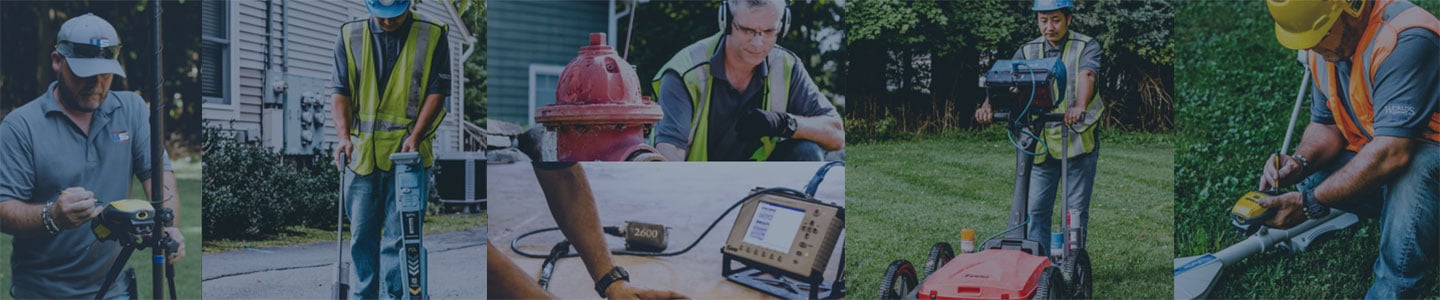
Having multiple underground locating technologies available simultaneously, which include GPR, Radio Frequency (RF) Pipe and Cable Locators and Electro-Magnetic Profiling Locators build the case for thorough utility locating surveys. The wide variety of underground locating technologies can confirm what was previously found as well as discovering new utilities. Each technology has its own specific strengths and maximizing those strengths provides a more sound utility locate.
GPR for Hollow Pipes and Non-Conductive Materials

GPR, or Ground Penetrating Radar, is essential for locating hollow, non-conductive pipes and conduits. GPR is a wave-based technology similar to aerial radar or a fish-finder SONAR. The GPR software will give the technician a real-time image of what the wave reflects off of. Images are shaped as peaks and hyperbolas. Experience is key for the operating Technician to know what may be a target utility versus an anomaly.
Radio Frequency (RF) Pipe and Cable Locators
Radio Frequency Pipe and Cable (RF) locators are the bread and butter for any sound utility mark-out. These locators use radio frequencies that are either conducted (direct attachment) or inducted (generated through the ground) onto pipes or cables that lend themselves to carrying a radio wave. A receiver is then employed in picking up the generated signal and following it as it runs beneath the ground. An experienced technician can interpret good traces from ghost traces and establish a good locate. RF locators are useful for conductive materials only.
Electromagnetic (EM) Profiling Locators
 Electromagnetic (EM) Profiling Locators use electromagnetic waves to profile the conductivity or resistivity of the ground and provide imaging based on those values. These images can often narrow a search area so that an underground tank or structure can be found. Corresponding utilities can then be located with the previously mentioned technologies.
So why do we use so many different utility locating technologies? Because maximizing the potential of each locating technology in combination with experienced professional technicians is what has made us at Utility Survey Corp. the specialists in our field since 1989.
What assures that you get a thorough utility locating service? Download our "10-Step Utility Locating Protocol" to see what steps our technicians follow when they arrive on your site.