

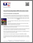
Find out more about more about the Power of GPR in our GPR Information Guide, including a picture of an actual GPR image.
Find out more about more about the Power of GPR in our GPR Information Guide, including a picture of an actual GPR image.
Find out more about more about the Power of GPR in our GPR Information Guide, including a picture of an actual GPR image.
Find out more about more about the Power of GPR in our GPR Information Guide, including a picture of an actual GPR image.

You can also call US toll-free on
800-825-9283

 845-496-2550 845-496-2548


87 East Main Street
Washingtonville,
NY 10992


