For soil and water samplings in environmental investigations, drilling locations are usually chosen strategically, as unlimited locations are not an option. One type of location of interest is where former underground storage tanks (USTs) were, but have now been removed.
Drilling locations are preferably chosen in and around excavation areas of former USTs to determine the levels of possible contamination. A few feet of difference could mean catching or missing contamination.
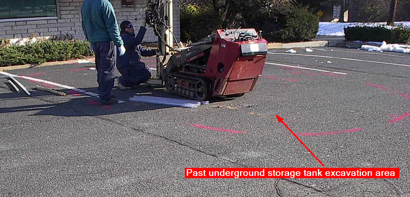
However, sometimes exact excavation locations are not known due to lack or inaccuracy of records. Actual excavation areas could be paved over many times and no visible signs of excavation are left.
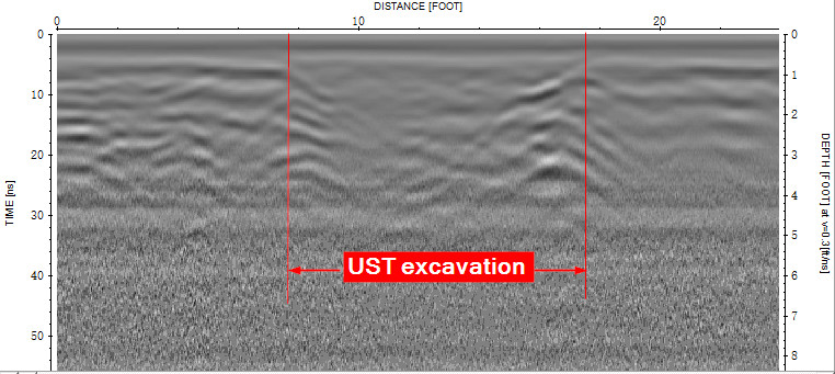
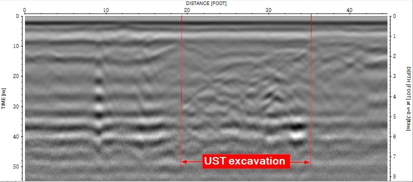
Ground penetrating radar (GPR) is a great tool not only for locating USTs themselves, but also their excavation areas.
Below are some GPR profiles showing very good evidences of past excavations:
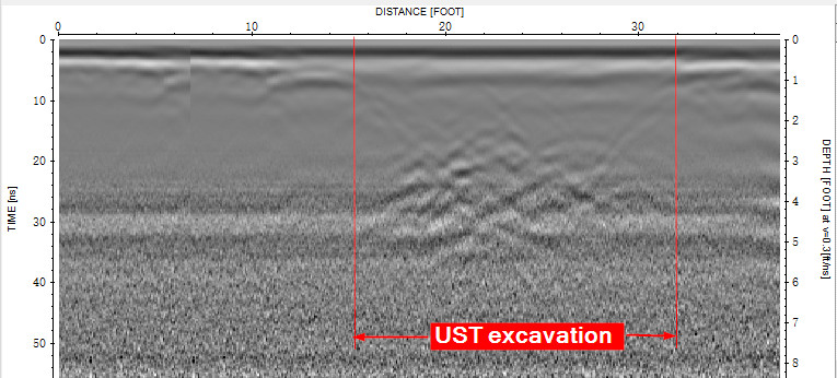
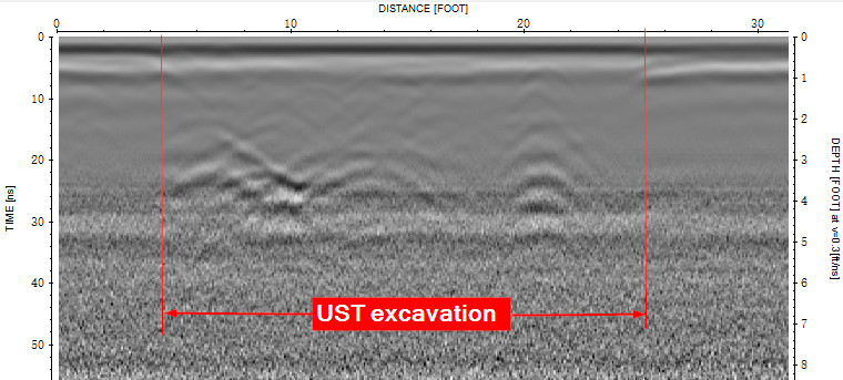
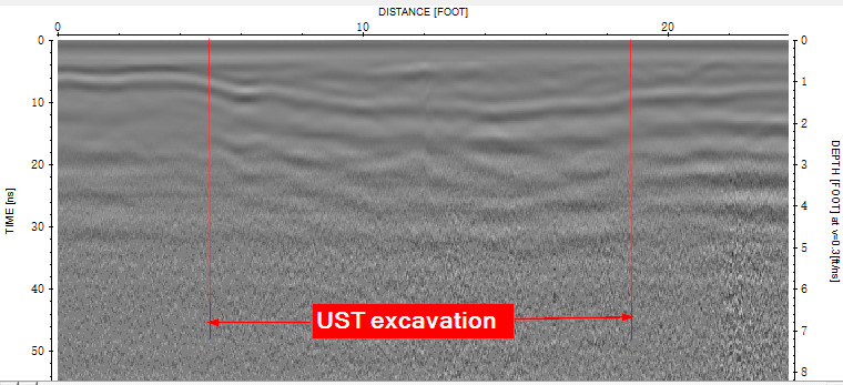
As any other geophysical tools, GPR is not 100 percent fail-proof. Some past excavation areas could be much less obvious in GPR data.
Below are a couple of GPR data examples where excavation areas are kind of shown, but not very convincing.
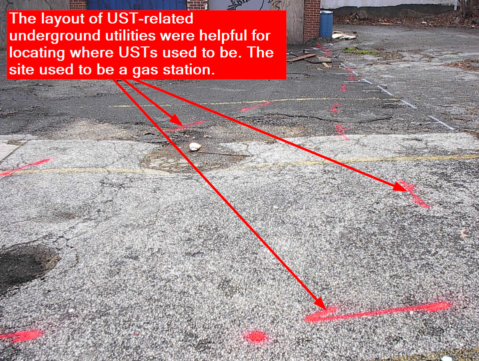
In these cases, depending on the settings, sometimes locating UST associated features, such as piping, foundations of pumping islands, etc are helpful for determining their locations.
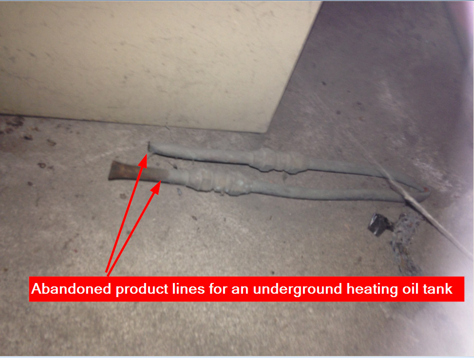
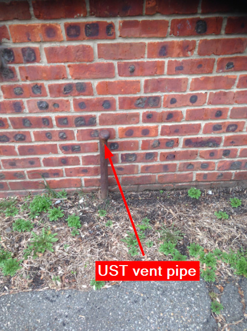
Most common UST related features include vent pipes, product lines, and electrical conduits.
With tools commonly used in underground utility locating including cable/pipe locators together with GPR, we can often find the associated vent pipes, etc. and these can lead us to where the USTs are or used to be.
Here are a few examples...
Besides GPR and cable/locators, other tools such as metal detectors and ground conductivity meters could also be helpful in some situations by searching for circumstantial evidences or anomalies.
Every site is unique, and the previous experiences of the surveyor could play a critical role in locating past UST excavation areas.
No matter whether it's for locating past UST excavation areas, UST themselves, or other underground targets, at Utility Survey Corp., we will utilize our expertise in geophysical surveys to assist you in environmental investigations.
Find out more about the other equipment we have available in our
Utility Locating Terminology and Equipment Guide by downloading below!